Into the caldera
Weather today was pretty wild and wintry a day for staying down low! Took a walk along the track beside Loch Ba as far as Glen Clachaig - there is some great mountain scenery in the area and of course it is the location for the world famous Loch Ba Ring dyke. I wanted to have a look at the hills with a bit of snow on them as it often brings out detail that is hard to see otherwise. The pictures below give an idea. Click on the images to see them larger!

The Loch Ba Ring Dyke (LBRD) follows the wintry skyline. Seen from near Gruline
Moving on to the track by the loch, the weather started to clear but was still quite wild:


Looking up at the ridge of Beinn a Ghraig - the LBRD is the prominent rocky ridge on the LHS. The snow pics out the contact at the base quite well.


The Loch Ba Ring Dyke (LBRD) follows the wintry skyline. Seen from near Gruline
Moving on to the track by the loch, the weather started to clear but was still quite wild:

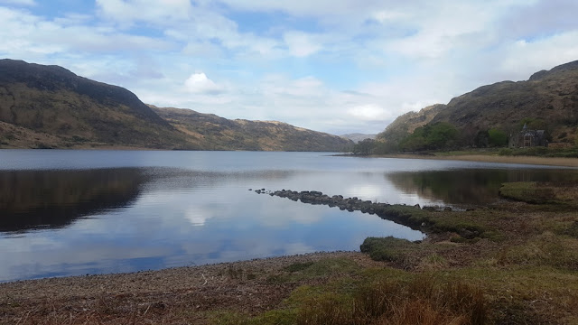
View up the loch!
Moving on this prominent hill is on the RHS:

The LBRD runs through this un-named hill down to the loch side. The exposed rock sene at the top is the felsite with basic inclusions that makes up most of the dyke. There are also some noticeable parallel gullies running across the hill. I havent been to investigate these, but they might be dykes of the Mull Swarm that cut the LBRD. As the LBRD is one of the last igneous features in Mull, then these other dykes that cut across must be represent some of the last igneous activity in the area. One of the dykes further up the hill has weathered out into a deep chasm
Looking across the loch:

The snow covered peak (not very clear) is called Na Bacannan and is the end of a ridge. The LBRD runs over this

This hill is called Sron nam Boc - the LBRD runs straight over this hill. Although the LBRD appears like a wall of rock on the SW side of the loch, on the other side, the BE side, it isnt so obvious. After this point on the track we are effectively inside the volcanic caldera. The LBRD itself has been described as "the most perfect example of a ring dyke known to science” (Bailey et al in the Mull Memoir, 1924)
The weather was starting to improve:


Two photos of Beinn na Duatharach. The dark crags are of gabbro. There doesnt appear to be any studies done on this gabbro as far as I can find. A search on Google Scholar only throws up an ancient paper by Prof Judd (1899) in which he refers to the hill and gives an alternative name "Beinn Uaig" His 1899 paper refers to another dating from 1874. I need to check the Mull Memoir of 1824 to see if there is anything. I dont think there is,
Moving on:

The very snowy hill is Ben Talla at the head of Gen Forsa. The LBRD runs across the foot of this hill but is really hard to find.
Most of the rock that surrounds Loch Ba is the Glen Cannel Granophyre - on the BGS map it is really obvious and covers a big area. Appears to be the largest body of granophyre in Mull (by area anyway). Despite this, it is really hard to find in situ near the loch - there are only a couple of places where it can be sen without going up the hill. Near the cottage of Clachaig, it is exposed in a stream near a bridge:

Granophyre (the cream coloured rock) in the stream bed cut by a small zig-zagging dyke
This was the furthest point out I went to - heading back in the weather improved but was still pretty wild.

Looking up at the ridge of Beinn a Ghraig - the LBRD is the prominent rocky ridge on the LHS. The snow pics out the contact at the base quite well.

A final look back up the loch.


Comments
BGS Memoir http://pubs.bgs.ac.uk/publications.html?pubID=B01897
The Edinburgh Geological Society Ardnamurchan field guide on Earthwise at http://earthwise.bgs.ac.uk/index.php/Ardnamurchan_%E2%80%93_a_guide_to_geological_excursions
Earthwise is an open platform and seeks contributors :-)
Bob