North Mull Mesozoic Rocks (2) North of Rubha nan Gall
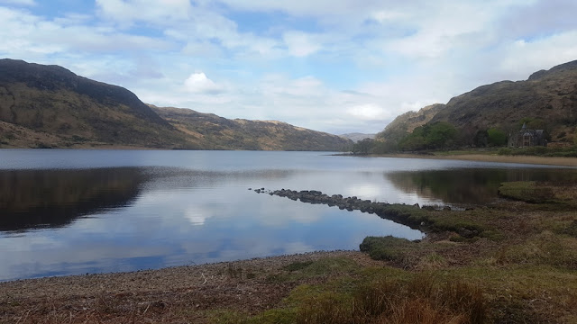
This week's Mesozoic outing was to the area just north of the lighthouse at Rubha nan Gall, just north of Tobermory. This is one of the few places in North Mull where the rocks that underlie the Palaeocene volcanics can be seen. It is easy to get to the lighthouse now as the path has been upgraded. From the lighthouse beyond to where these rocks are takes a bit more effort but nothing too hard.And the views are superb.
I had been to the lighthouse last year. Details are here:
http://mullgeology.blogspot.co.uk/2017/11/lighthouse-path-walk-19-nov-2017.html
Hopefully not repeating myself this time. Anyway, here are some pics and information about todays walk:
Pictures and details below:
Donations box at the start of the path - still more needed for maintenance
It weathers to this really hackly looking rock. Very hard and sharp!
Another view showing the limestone and the mudstone layers These rocks look totally unlike the lavas which make up the vast majority of the rocks of the area. Quite unmistakable.
Looking at the outcrop and the lighthouse. The large boulder is of lava that has come down from the cliff
Some
Some rather nice amygdales in the beach boulders. None of this is in situ and has presumably come down from the cliffs above
I had been to the lighthouse last year. Details are here:
http://mullgeology.blogspot.co.uk/2017/11/lighthouse-path-walk-19-nov-2017.html
Hopefully not repeating myself this time. Anyway, here are some pics and information about todays walk:
Pictures and details below:
Donations box at the start of the path - still more needed for maintenance
Dont know how I missed this the last time I was here a few weeks ago - a dyke cutting through the lavas. You can see the dyke "side on" a little bit further along the path and I think it may be the same dyke that is seen later near the lighthouse
The lighthouse seen from near the direction indicator. Ardnamurchan in the distance
There are two obvious outcrops of the Mesozoic rocks - the one nearer the lighthouse was covered by the tide. This is the further away of the two. The layering is clearly visible and it dips very slightly to the south. The rock is alternate layers of a silty rock with what looks like a limestone in between. Both are extremely hard. According to the BGS map, the rock is Lower Jurassic Blue Lias , described as "Mudstone, calcareous mudstone and nodular limestone, rhythmically and thinly bedded" Sounds a bit like what I saw! Close-ups below:
Another view showing the limestone and the mudstone layers These rocks look totally unlike the lavas which make up the vast majority of the rocks of the area. Quite unmistakable.
This is the top view showing the appearance of the rock. It is the limestone that gives this surface. Where the silty mudstone is exposed, the top surface is much smoother and less hackly
On top of the outcrop looking over to Ardnamurchan
The vague path continues beyond here but eventually the cliff goes straight into the sea so its a case of back the way I came. There are some interesting things to see among the volcanic rocks on the shore:
Some
Some rather nice amygdales in the beach boulders. None of this is in situ and has presumably come down from the cliffs above
Looked like calcite on the LHS and quartz on the RHS in this one
I also spotted this bit of fallen column:
Definitely a piece of columnar basalt
And in the cliffs above, the columns can be seen. OK, nothing like Staffa, but definitely columns IMO!
And that was that, back to Tobermory and breakfast.


Comments