North Mull Mesozoic Rocks (3) North of Ardnacross
On the BGS map North Mull and Ardnamurchan, there are a couple of small outcrops of Mesozoic strata just south of Tobermory and north of Ardnacross Farm. These are the rocks that underlie the volcanics. The volcanics are of Palaeocene age ( approx 60 million years old) but the underlying Mesozoic rocks, depending on exactly what they are can be from about 248 million years ago up to 65 million years. So depending on what they are, they could be considerably older
Rocks of this type probably underlie most of Mull but it is only in certain coastal locations (and also as xenoliths and in volcanic vents) that we can readily see them.
This particular outcrop had intrigued me for a while and it was long overdue a visit. Many thanks to Rory Forrester of Ardnacross Farm for letting me explore at leisure!
The view down the sound of Mull is great:
Thin dyke cutting the sediments
I took a video clip of the area:
Yes, it was windy, hence the noise!
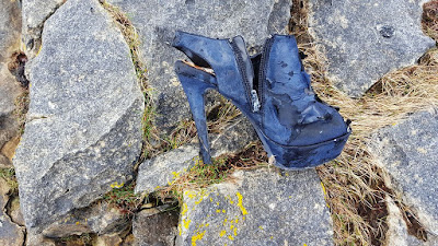
One of the joys of walking along the shore is that you never know what surprise lies round the next corner:
Not exactly ideal footwear for geologising!
Anyway, back to the car it was having seen enough. I suspect it is a location that doesnt get a lot of visitors. Most people coming to Mull who want to look at classic Mesozoic rocks will go straight to either Carsaig or Gribun. Needless to say I didnt meet many people once I was away from the farm!
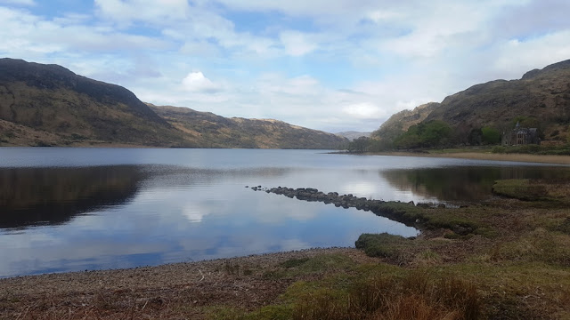
The final view was great:
Rocks of this type probably underlie most of Mull but it is only in certain coastal locations (and also as xenoliths and in volcanic vents) that we can readily see them.
This particular outcrop had intrigued me for a while and it was long overdue a visit. Many thanks to Rory Forrester of Ardnacross Farm for letting me explore at leisure!
The view down the sound of Mull is great:
The Sound of Mull looks quite wide at this point. Ben Talla has snow on top as do the hills above Craignure
Its not just the geology - there is a broch here. Not a big one like you get in Lewis, Glenelg or Shetland, but a broch nonetheless
The broch is that hump of stones in the middle... Morvern on the other side of the water
Most of the rock around here is not basalt - it is trachyte, a much more evolved type of igneous rock. It is part of a volcanic plug, one of several in North Mull and Morvern, the subject of a rather excellent paper by Andrew Kerr:
All you need to read is in there (although you will need an academic login, paid access or get it as a member of certain geological societies.
The trachyte looks nothing like the basalt. It is platy, cream to light grey in colour and breaks up into flat sheets that make a really distinctive noise when you walk on it
Close up of the trachyte showing the platy nature of it. Not a great pic I know but its really hard to photograph!
A bit further north the trachyte is cut by what looks like two dykes but I think it is just one, erode down the middle
Dyke cutting the trachyte - notice the platy boulders on the shore. Ben Hiant in the distance
A trudge along a rough path for about 1 km brings you to the start of the Mesozoic rocks:
where it forms a very obvious rocky platform
Basalt lavas in the cliffs. A fallen boulder lies on the Mesozoic rocks. View north
According to the BGS map, the rocks here are of the Stornoway Formation which is very lowest Jurassic and possibly Upper Triassic. The Triassic / Jurassic boundary lies about 201 million years ago. The rocks are mainly fine grained sandstones and calcareous mudstone. Some more detailed pics follow.
In this photo the layering can be seen . The rocks are very hard and hackly - the weathering has produced a hard brittle hackly surface.
The more calcareous layers give this hard brittle surface. The sandstone layers are a bit smoother and not so rough, but are criss crossed by what looks like veins. I think they may be dessication type cracks, similar to the rocks you see at Gribun. If they are Triassic they are of similar age
The criss-crossing material stands up proud of the surface. this is what is seen at Gribun as well.
A lot of the ground is covered in small boulders which must have come from the cliffs. They look kind of strange:
There are some very large boulders as well - one of them looks like a standing stone:
Large basalt boulder on the platform. Ben Hiant in the distance
There is a dyke of Palaeocene age cutting the sedimentary rocks. It has several offsets in it and is discontinuous. The centre looks drusy:
Thin dyke cutting the sediments
I took a video clip of the area:
One of the joys of walking along the shore is that you never know what surprise lies round the next corner:
Not exactly ideal footwear for geologising!
Anyway, back to the car it was having seen enough. I suspect it is a location that doesnt get a lot of visitors. Most people coming to Mull who want to look at classic Mesozoic rocks will go straight to either Carsaig or Gribun. Needless to say I didnt meet many people once I was away from the farm!
The final view was great:


Comments